Translate

Showing posts with label * UNESCO Tentative. Show all posts

GERMANY - Bavarian Castles

Thank you so much Heidi for sharing with me this postcard showing different Bavarian castles!


INDIA - Evolution of Temple Architecture – Aihole-Badami- Pattadakal

Thank you so much to Bishnu for sending me below 3 cards showing UNESCO Tentative Site of his country, India.

Postcard 1


Postcard 2


Postcard 3

BRAZIL - Gold Route in Parati and its landscape

Thank you so much for choosing this postcard for me, Joao!
A UNESCO Tentative Site!
I like the stamps too with colorful birds!


ESTONIA - Kuressaare Fortress

"Top left shows Kuressaare Fortress, which is included on the UNESCO Tentative List", shares Janne.
Thank you so much, Janne for increasing my UNESCO Tentative List postcards! ^-^


ESTONIA - Baltic Klint

" The Baltic Klint is an erosional limestone escarpment on several islands
 of the Baltic Sea. This is included on the UNESCO Tentative List.", shares Janne.
Thank you so much, Janne for this wonderful postcard
and for using the year of the dog stamp!

PAKISTAN - Uch Sharif

This poscard shows Uch Sharif which contains the tombs of Bibi Jawindi, Baha'al-Halim, Ustad Nuriya and Jalaluddin Bukhari, which are considered masterpieces of Islamic architecture and are on the UNESCO Site Tentative List.
Thank you so much Imran for sending me this postcard!


CROATIA - The Historic town of Korčula

"The form of the town of Korčula is primarily determined by the form of the little peninsula protruding into Channel of PeljeSac, (large about l nlm), on the northern side of the island of Korčula, (superficies about 272 km2). The strategic position favoured, and the natural setting enabled its complete encirclement with walls, which correspond with the line of the sea shore. They enclose the ellipse, (310x175 m), of the domical hill with the large cathedral and high belfry rising on the top. The surrounding architecture covers the entire perimeter of the peninsula, and its only connection with the main island is cut off by an artificial trench." -http://whc.unesco.org


Thank you so much Dragan for this surprise postcard!
Am quite embarrassed to show you this because I got this damaged last December...
But this is so much appreciated and will be treasured!


You may visit Dragan's blog here...

LITHUANIA - Trakai Historical National Park

"Trakai Park lies in the eastern part of the Lithuanian Republic, 25 km to the west of the capital city, Vilnius. Trakai Park stands in the Dzukija Upland area of the Baltic uplands at a height of 102-228 m above sea level. It covers an area of wooded lake land in eastern Dzukija, which is centred on the historical town of Trakai. Trakai Park was founded in 1991 by the Lithuanian Restoration Seimas in order to preserve cultural sites of Lithuanian historical statehood along with their genuine natural environs. In this unique and compact ensemble of natural and cultural heritage, which reflects important periods and events in the history of Lithuania and eastern Europe as a whole, we can see a beautifully preserved cultural landscape centred on an historic town and castles which are nestled in lake land..." -http://whc.unesco.org


Thank you so much Leva for sending me this postcard showing the lone UNESCO Tentative Site from your country! Special thanks for the Lithuanian Postcrossing Stamp!


PHILIPPINES - Mount Apo Natural Park

"The 64,053.00 hectares Mount Apo Natural Park is dominated by the highest mountain in the Philippine archipelago, the majestic Mt. Apo, a volcanic mountain rising to 3,143.6 meters above sea level. Mt Apo hosts five (5) distinct forest formations, from lowland forest to low montane forest, high montane forest and finally to summit or scrub forest. In addition to variations in its topography, interactions of other factors, such as, climate, soil, geology, slope and drainage have allowed for the development of a wide diversity in plant community types and associations in the region.

The property is the habitat of a total of 227 vertebrate species belonging to 59 families of amphibians, reptiles, birds and mammals. Likewise, 118 species of butterflies belonging to 69 families are recorded in the area. There are 272 species of birds, wherein 111 (40%) are endemic to Mount Apo and 2 species are in the critical list. One endemic but critically endangered bird species is Pithecophaga jefferyi (Philippine Eagle) whose remaining population is believed to be only around 500. The Philippine eagle is of outstanding universal value for science and conservation, whose nesting and feeding areas are located in dipterocarp forests including closed canopy forests. It is the second largest eagle in the world. The aviator Charles Lindbergh, as representative of the World Wildlife Fund, proclaimed it as "the air's noblest flyer." The Philippine eagle is the nation's symbol and is locally known as "haribon" or bird king. With a wingspan of two meters, this bird of prey boasts the largest surface area in its wings among all eagle species. Like the giant panda of the Sichuan Giant Panda Sanctuary, recently inscribed as a World Heritage Site at the 30th Session of the World Heritage Committee in Vilnius last July, the Philippine eagle is a wonder of nature of great charisma. This bird is not found elsewhere in the world and has become the symbol of Philippine conservation efforts. Widespread destruction of its habitat and collection is driving this species to extinction.  Another endemic bird species in the critical list is Cacatua heamatopygia (Abukay)." -http://whc.unesco.org


A postcard I bought in Davao, Philippines during our 2013 family vacation which I sent for my kids (ages 2 and 6) back home so they'll be able to read one day some of the activities we had during our trip.


PHOTOS

Visiting the Japanese Tunnel

At the SUL Orchids Center
  
My kids at the Philippine Eagle Center

ANDORRA - Romanesque Churches in Andorra (Correos)

"This site is composed of the following monuments:
- Sant Joan de Caselles
- Sant Miquel d'Engolasters
- Historic Ensemble Pal
- Historic Ensemble of the Cortinada
- Historic Ensemble of the Warrants
- Sant Serni of Nagol
- Bell tower and porch of Santa Eulalia Encamp
- Tower of Sant Julia i Sant Germà" -http://whc.unesco.org
Thanks much for my first 2 written and stamped postcards from Andorra, Fabienne! :)

CROATIA - Zadar - Episcopal complex

"The area proposed for inscription in the World Heritage List is located in the centre of the historic nucleus of the town of Zadar and comprises the Roman forum with the remains of a temple, the Episcopal complex with the cathedral of St. Anastasia, the archbishop’s palace, the church of St. Donatus and the Zmajevic seminary, the orthodox church of St. Elias, the Benedictine nunnery with the church of St. Mary and the Permanent Exhibition of Religious Art, and the Archaeological Museum. The area of the complex is 3 hectares, and it is surrounded by the protected historic nucleus of the town of Zadar, which is also the buffer zone. In the second half of the first century B.C. the Liburnian settlement of Zadar became a Roman colony, and developed in accordance with the town planning scheme typical of the Roman tradition used in the design of military camps (castra)...." -http://whc.unesco.org


Thank you so much Antonella for this wonderful card showing Zadar!

BULGARIA - The Magoura cave with drawings from the bronze age

"The cave is located near the village of Rabisha, in the district of Vidin. The beginnings of the formation of the cave go back 15 million years ago on a hill which is 461 meters high. The cave has a number of accessible halls and galleries which were inhabited during the Bronze Age and which contain remnants of settlements and drawings on the walls. The remnants in the largest hall bear evidence to the existence of life from 3100 years to 900 years before our era - i.e. the early Iron Age. In one of the side galleries a large number of ritual drawings can be seen, which are among the masterpieces of late prehistoric art in Europe. In all probability, this gallery was a cult shrine of the cave prehistoric settlement. The Magoura Cave has been declared a monument of culture and a remarkable natural site. Provisions have been made for its preservation. The cave is open to visitors." -http://whc.unesco.org


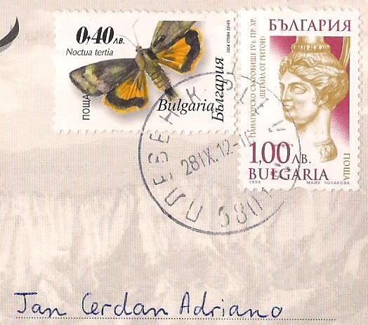
 Great card with great stamp!
Thank you so much Lilia for sharing this with me! :)

BULGARIA - The town of Melnik and the Rozhen Monastery

"The town, the mediaeval fortress above it and the monastery (5 km from the town) are all located in an unusual surrounding of natural sand pyramids and a canyon of fantastically shaped eroded roc is a remarkable collection of architectural, artistic and archaeological monuments of major historical significance. Most important among them are the three-storey feudal castle, the mediaeval churches containing most valuable icons of the 13th to l9th century. The typical house architecture of the 18th and l9th centuries is notable indeed. Erected during the Middle Ages, the Rozhen Monastery has preserved its three portions added to it in the 16th, 17th, 18th and l9th centuries. The murals were painted from the 16th through the 18th centuries. Three unique wood-carved altars and over one hundred highly valued icons ha also been preserved. The monastery is a genuine masterpiece of art which was created in the course of several centuries." -http://whc.unesco.org


"Melnik is an architectural reserve and 96 of its buildings are cultural monuments.
With a population of 385, it is the smallest town in Bulgaria and retains its city status today for historical reasons only.
I have been there several times and it's really a wonderful place...", shares Nadezhda.
Thank you so much Nadezhda for this wonderful postcard! =)

TURKEY - Mardin Cultural Landscape

"Mardin is a city in a rocky region in southeastern Anatolia. The city is mainly medieval in origin and is situated on the slopes of a rocky hill, crowned by o fortress built on its citadel. This barren stoney region around Diyarbaklr and Mardin stretches as for as Sanliurfa and Gaziantep. The city as a whole with its traditional stone, religious and vernacular architecture and its terraced urban pattern is the best preserved example of Anatolian soil. Deyrulzafaran Monastery is one of the living religious center of Syriandacobites in Mardin, an impressive architectural complex in the Mesopotamian plain." -http://whc.unesco.org


"This is a view from Mardin, the city located southeastern of Turkey.
Mardin is full of history... It has mixed different religions.
You can find a Mosque next to a Church.", shares Deniz.
Thank you so much Deniz for sharing this postcard with me! =)
 

INDONESIA - Raja Ampat Islands

"The Raja Ampat Islands, situated near the Northwest coast of Papua, consists of about 1,500 islands, including several large, mountainous islands, the largest being Waigeo, Batanta, Salawati and Misool. The land and surrounding sea occupy approximately 46,000 km2 or about 4.6 million ha. The islands are located in a region on the western boarder of the equatorial Pacific Ocean and at the Northeastern ‘entrance’ of the Indonesian Throughflow from the Pacific to the Indian Ocean. The vast majority of the archipelago rests on the Sahul shelf. The wide distribution of small islands across the shelf edge creates a strong gradient from clear water, open oceanic conditions to sheltered and turbid bays, surrounded by krast limestone formations. Raja Ampat was declared as a new regency or district on 8 May 2003 and consists of 10 sub-districts with a total of 85 villages spread out in over approximately 6% of the islands in the regency. The census in 2001 showed that total population in Raja Ampat was 47,771 with an average increase rate of 0.32% (Pemda Raja Ampat, 2002). " -http://whc.unesco.org


"Raja Ampat or Four Kings Islands are located at the Northwest tip
of Bird's Head Peninsula (New Guinea), in West Papua Province of Indonesia.
It has the highest marine life diversity recorded on earth,
and the richest coral reef ecosystems", shares Shinta.
Thank you so much Shinta for sharing with me this postcard with amazing view!

INDONESIA - Wakatobi National Park

"Wakatobi National Park has very high marine resource potential, in terms of both species and uniqueness, with enchanting submarine landscapes. In terms of configuration, the marine waters of the park generally start flat and then slope seawards, with sheer precipices in some parts. The water depth varies, the deepest parts reaching 1,044 metres with sand and coral at the bottom. This Park has 25 chains of coral reefs, and the total circumference of the coral islands is 600 km. The National Park includes an area of 1,390,000 hectares. " -http://whc.unesco.org


Thank you so much for this postcard, Jennifer!
I miss snorkeling...